File:Filling in part of the mouth of the Keating Channel, 2018-07-04 -a.jpg
Jump to navigation
Jump to search

Size of this preview: 800 × 367 pixels. Other resolution: 2,720 × 1,248 pixels.
Original file (2,720 × 1,248 pixels, file size: 893 KB, MIME type: image/jpeg)
Summary
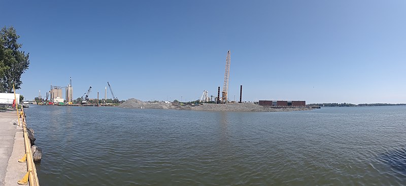
| Description | Filling in part of the mouth of the Keating Channel is part of naturalizing the Mouth of Don River (Ontario) and the creation of Villiers Island. |
| Date | |
| Source | 20180704_152835 |
| Author | booledozer |
| Camera location | | View this and other nearby images on: OpenStreetMap |
|---|
Licensing
| This file is made available under the Creative Commons CC0 1.0 Universal Public Domain Dedication. | |
| The person who associated a work with this deed has dedicated the work to the public domain by waiving all of their rights to the work worldwide under copyright law, including all related and neighboring rights, to the extent allowed by law. You can copy, modify, distribute and perform the work, even for commercial purposes, all without asking permission.
|
| This image was originally posted to Flickr by booledozer at https://flickr.com/photos/55289779@N00/28334547167 (archive). It was reviewed on 5 July 2018 by FlickreviewR 2 and was confirmed to be licensed under the terms of the cc-zero. |
File history
Click on a date/time to view the file as it appeared at that time.
| Date/Time | Thumbnail | Dimensions | User | Comment | |
|---|---|---|---|---|---|
| current | 22:30, 4 July 2018 | | 2,720 × 1,248 (893 KB) | imagescommonswiki>FlickreviewR 2 | Replacing image by its original image from Flickr |
File usage
The following file is a duplicate of this file (more details):
- File:Filling in part of the mouth of the Keating Channel, 2018-07-04 -a.jpg from Wikimedia Commons
The following 2 pages use this file: