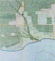
File:Lower course of Garrison Creek, 1818.jpg

From Citizendium
Jump to navigation Jump to search

Lower_course_of_Garrison_Creek,_1818.jpg(185 × 204 pixels, file size: 34 KB, MIME type: image/jpeg)

This file is from a shared repository and may be used by other projects. The description on its file description page there is shown below.

Description 1818_map_of_York,_Upper_Canada.
Date (UTC)
Source
Author


This is a retouched picture, which means that it has been digitally altered from its original version. Modifications: cropped. The original can be viewed here: 1818 map of York, Upper Canada.jpg. Modifications made by Geo Swan.


Public domain
This Canadian work is in the public domain in Canada because its copyright has expired due to one of the following:
1. it was subject to Crown copyright and was first published more than 50 years ago, or

it was not subject to Crown copyright, and

2. it is a photograph that was created prior to January 1, 1949, or
3. the creator died prior to January 1, 1972.

You must also include a United States public domain tag to indicate why this work is in the public domain in the United States.

العربية  বাংলা  čeština  Deutsch  English  español  suomi  français  italiano  日本語  한국어  македонски  മലയാളം  Nederlands  português  português do Brasil  sicilianu  slovenščina  简体中文  繁體中文  +/−

Original upload log

This image is a derivative work of the following images:

  • File:1818_map_of_York,_Upper_Canada.jpg licensed with PD-Canada
    • 2009-10-18T01:13:01Z Geo Swan 406x351 (51149 Bytes) {{Information |Description=1818_map_of_York,_Upper_Canada. |Source=http://www.rbebout.com/queen/2pline.htm |Date=1818 |Author=unknown |Permission={{PD-Canada}} |other_versions= }} [[Category:Toronto Waterfront]] [[Category:Yo

Uploaded with derivativeFX

Captions

Add a one-line explanation of what this file represents

Items portrayed in this file

depicts

27 February 2011

File history

Click on a date/time to view the file as it appeared at that time.

Date/TimeThumbnailDimensionsUserComment
current02:34, 27 February 2011Thumbnail for version as of 02:34, 27 February 2011185 × 204 (34 KB)imagescommonswiki>Geo Swan{{Information |Description=1818_map_of_York,_Upper_Canada. |Source=*File:1818_map_of_York,_Upper_Canada.jpg |Date=2011-02-27 08:27 (UTC) |Author=*File:1818_map_of_York,_Upper_Canada.jpg: {{unknown}} *derivative work: ~~~ |Permission= |other_ve

The following file is a duplicate of this file (more details):

There are no pages that use this file.
Metadata