File:NOAA map of Duck Galloo Ridge.jpg
Jump to navigation
Jump to search

Size of this preview: 736 × 599 pixels. Other resolutions: 2,515 × 2,048 pixels | 2,736 × 2,228 pixels.
Original file (2,736 × 2,228 pixels, file size: 3.47 MB, MIME type: image/jpeg)
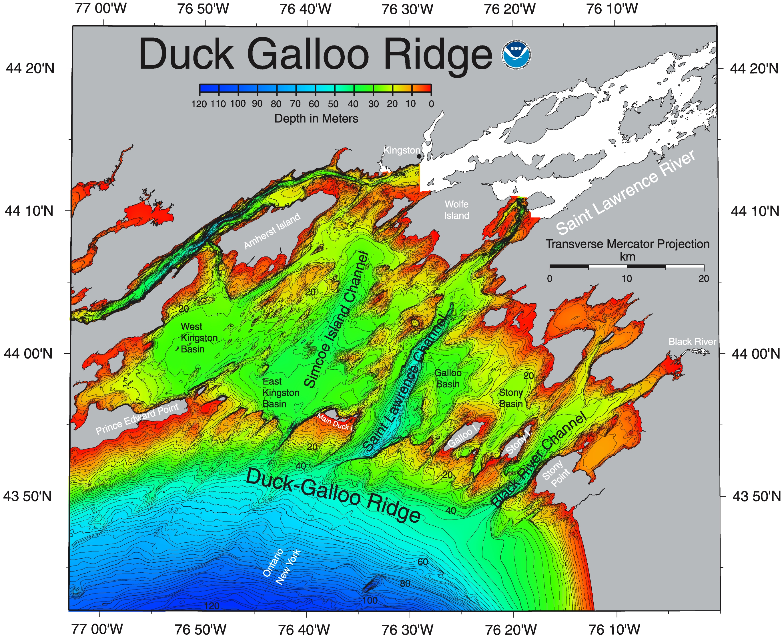
| Description | This NOAA map of Duck Galloo Ridge shows the Northeast corner of Lake Ontario. As lakes go Lake Ontario is relatively deep. The portion north of this ridge is significantly less deep. | |||
| Source | https://ngdc.noaa.gov/mgg/greatlakes/lakeontario_cdrom/html/newnames.htm | |||
| Author | ||||
| Permission (Reusing this file) |
|
|||
| Other versions |
_showing_Timber,_Swetman,_Main_Duck_and_Yorkshire_islands,_and_some_subsurface_shoals.jpg)
File history
Click on a date/time to view the file as it appeared at that time.
| Date/Time | Thumbnail | Dimensions | User | Comment | |
|---|---|---|---|---|---|
| current | 20:14, 22 June 2017 | | 2,736 × 2,228 (3.47 MB) | imagescommonswiki>Geo Swan | {{Information |Description=This {{w|NOAA}} map of {{w|Duck Galloo Ridge}} shows the Northeast corner of {{w|Lake Ontario}}. As lakes go Lake Ontario is relatively deep. The portion north of this ridge is significantly less deep. |Source=https://ngdc.... |
File usage
The following file is a duplicate of this file (more details):
- File:NOAA map of Duck Galloo Ridge.jpg from Wikimedia Commons
There are no pages that use this file.