File:NOAAfisheriesServiceNEregionDemarcation.gif
Jump to navigation
Jump to search
No higher resolution available.
NOAAfisheriesServiceNEregionDemarcation.gif (724 × 483 pixels, file size: 99 KB, MIME type: image/gif)
Summary
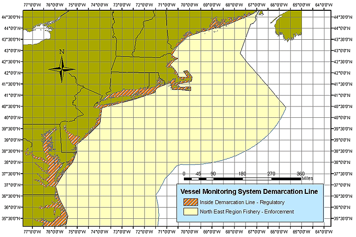
| Description | Northeast Region Fisheries Demarcation Lines |
| Date | |
| Source | http://www.nero.noaa.gov/nero/fishermen/multispecies/gom/VMSDemarcLine.htm |
| Author | US (Government) National Oceanographic and Atmospheric Administration |
Map of Northeast US fisheries where Vessel Management System must be used
Licensing
This image is in the public domain because it contains materials that originally came from the U.S. National Oceanic and Atmospheric Administration, taken or made as part of an employee's official duties.
|
File history
Click on a date/time to view the file as it appeared at that time.
| Date/Time | Thumbnail | Dimensions | User | Comment | |
|---|---|---|---|---|---|
| current | 21:50, 9 July 2007 | | 724 × 483 (99 KB) | imagescommonswiki>Hcberkowitz~commonswiki | {{Information |Description=Northeast Region Fisheries Demarcation Lines |Source=http://www.nero.noaa.gov/nero/fishermen/multispecies/gom/VMSDemarcLine.htm |Date=2007 |Author=US (Government) National Oceanographic and Atmospheric Administration |Permission |
File usage
The following file is a duplicate of this file (more details):
- File:NOAAfisheriesServiceNEregionDemarcation.gif from Wikimedia Commons
The following page uses this file: