Mission San Gabriel Arcángel/Gallery: Difference between revisions
imported>Robert A. Estremo m (add image) |
imported>Robert A. Estremo m (period) |
||
| Line 9: | Line 9: | ||
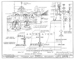
Image:Mission San Gabriel conceptual elevation - Rexford Newcomb 1916.jpg|{{Mission San Gabriel conceptual elevation - Rexford Newcomb 1916.jpg/credit}}<br/>Artist Rexford Newcomb's rendition of Mission San Gabriel Arcángel's original ''campanile'', or bell tower. The details are similar to those of the chapel at [[Mission Santa Inés]].<ref>Baer, p. 127</ref> | Image:Mission San Gabriel conceptual elevation - Rexford Newcomb 1916.jpg|{{Mission San Gabriel conceptual elevation - Rexford Newcomb 1916.jpg/credit}}<br/>Artist Rexford Newcomb's rendition of Mission San Gabriel Arcángel's original ''campanile'', or bell tower. The details are similar to those of the chapel at [[Mission Santa Inés]].<ref>Baer, p. 127</ref> | ||
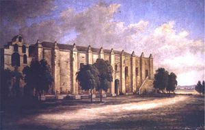
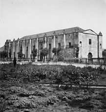
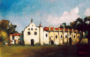
Image:Sparks Mission San Gabriel Arcangel.jpg|{{Sparks Mission San Gabriel Arcangel.jpg/credit}}<br />Mission San Gabriel Arcángel, between 1933 and 1937. | Image:Sparks Mission San Gabriel Arcangel.jpg|{{Sparks Mission San Gabriel Arcangel.jpg/credit}}<br />Mission San Gabriel Arcángel, between 1933 and 1937. | ||
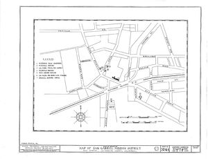
Image:Map of San Gabriel Mission District.jpg|{{Map of San Gabriel Mission District.jpg/credit}}<br />A map of the San Gabriel Mission District as prepared by the Historic American Buildings Survey in 1937 | Image:Map of San Gabriel Mission District.jpg|{{Map of San Gabriel Mission District.jpg/credit}}<br />A map of the San Gabriel Mission District as prepared by the Historic American Buildings Survey in 1937. | ||
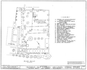
Image:Plot Plan of Mission San Gabriel.jpg|{{Plot Plan of Mission San Gabriel.jpg/credit}}<br />A plot plan of Mission San Gabriel Arcángel as prepared by the Historic American Buildings Survey in 1937. | Image:Plot Plan of Mission San Gabriel.jpg|{{Plot Plan of Mission San Gabriel.jpg/credit}}<br />A plot plan of Mission San Gabriel Arcángel as prepared by the Historic American Buildings Survey in 1937. | ||
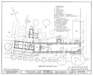
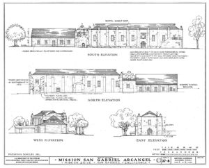
Image:Architectural Drawing of Church Mission San Gabriel.jpg.jpg|{{Architectural Drawing of Church Mission San Gabriel.jpg.jpg/credit}}<br />A floor plan drawing of Mission San Gabriel Arcángel as prepared by the Historic American Buildings Survey in 1937. | Image:Architectural Drawing of Church Mission San Gabriel.jpg.jpg|{{Architectural Drawing of Church Mission San Gabriel.jpg.jpg/credit}}<br />A floor plan drawing of Mission San Gabriel Arcángel as prepared by the Historic American Buildings Survey in 1937. | ||
Revision as of 13:38, 22 June 2013
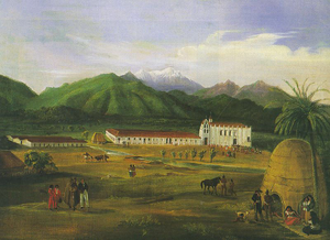
(PD) Painting: Ferdinand Deppe
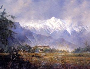
Mission San Gabriel Arcángel in 1832. In the foreground Native Americans (who frequently camped near trading centers such as military forts and missions) live in brush huts, with the Mission in the middle ground, and the San Gabriel Mountains as a backdrop. The work is believed to be the earliest known oil landscape of Southern California.(PD) Photo: Robert C. Post
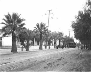
A streetcar of the Pacific Electric Railway makes a stop at Mission San Gabriel Arcángel circa 1905.
(PD) Drawing: Rexford Newcomb
Artist Rexford Newcomb's rendition of Mission San Gabriel Arcángel's original campanile, or bell tower. The details are similar to those of the chapel at Mission Santa Inés.[1](PD) Photo: United States Navy
USNS Mission San Gabriel (T-AO-124) was the fourteenth of twenty-seven Mission Buenaventura-class tankers built during World War II for service as fleet oilers in the United States Navy. Scrapped in 1975, she was the only U.S. Naval vessel to have borne the name.[2]
![(PD) Drawing: Rexford Newcomb Artist Rexford Newcomb's rendition of Mission San Gabriel Arcángel's original campanile, or bell tower. The details are similar to those of the chapel at Mission Santa Inés.[1]](/wiki/images/thumb/b/b1/Mission_San_Gabriel_conceptual_elevation_-_Rexford_Newcomb_1916.jpg/219px-Mission_San_Gabriel_conceptual_elevation_-_Rexford_Newcomb_1916.jpg)
![(PD) Photo: United States Navy USNS Mission San Gabriel (T-AO-124) was the fourteenth of twenty-seven Mission Buenaventura-class tankers built during World War II for service as fleet oilers in the United States Navy. Scrapped in 1975, she was the only U.S. Naval vessel to have borne the name.[2]](/wiki/images/thumb/d/d7/Mission_San_Gabriel_T-AO-124.jpg/300px-Mission_San_Gabriel_T-AO-124.jpg)