Laurentide glaciation
Jump to navigation
Jump to search
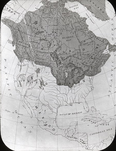
The Laurentide glaciation is the most recent continent-spanning glacier in North America.[1][2] It covered most of the northern half of North America for approximately 100,000 years, and started to recede 12 to 15 thousand years ago.
The most southerly extent of the glacier was in Ohio.[1][2]
Three earlier glaciers had spanned much of North America over the last half million years.[1][2]
References
- ↑ 1.0 1.1 1.2 Wayne Reeves, Christina Palassio. HTO, Toronto's Water from Lake Iroquois to Taddle Creek and Beyond, Coach House Books. Retrieved on 2018-09-29.
- ↑ 2.0 2.1 2.2 Ken Sharratt. geology-of-high-park. Retrieved on 2022-08-04. mirror
