< Air Resources LaboratoryRevision as of 18:11, 4 April 2012 by imported>Milton Beychok
This page is for the display of public domain images of the various kinds of monitoring equipment used by the Air Resources Laboratory (ARL) of the National Oceanic and Atmospheric Administration (NOAA).
Just below is a schematic of a modern weather station used by NOAA:
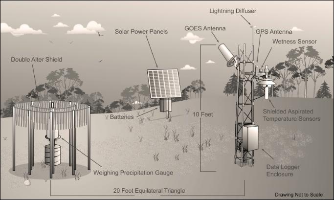
(PD) Diagram: National Oceanic and Atmospheric Administration NOAA has deployed a new network of weather stations as depicted in this schematic diagram. These stations focus solely on temperature and precipitation.
Below are various other photos of equipment used by the National Oceanic and Atmospheric Administration (NOAA) and its Air Resources Laboratory (ARL):
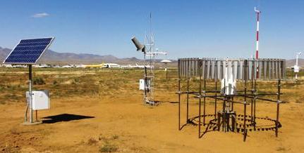 (PD) Photo: National Oceanic and Atmospheric Administration A Regional U.S. Climate Reference Network station at Kingman, AZ |
 (PD) Photo: National Oceanic and Atmospheric Administration Mercury research monitoring station at Beltsville, MD |
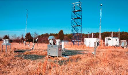
 (PD) Photo: National Oceanic and Atmospheric Administration A Surface Energy Budget station at Ft. Peck, Montana |
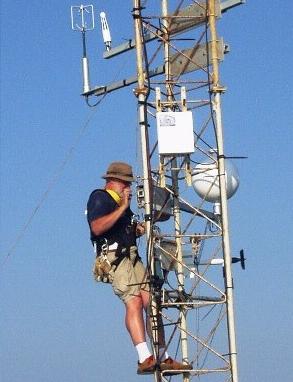 (PD) Photo: National Oceanic and Aymospheric Administration An ARL scientist deploying the ET probe on a tower at the end of a 560 meter pier in Duck, North Carolina for a hurricane study. |


