File:Map of San Gabriel Mission District.jpg
Original file (3,122 × 2,389 pixels, file size: 663 KB, MIME type: image/jpeg)
Summary
| Title / Description
|
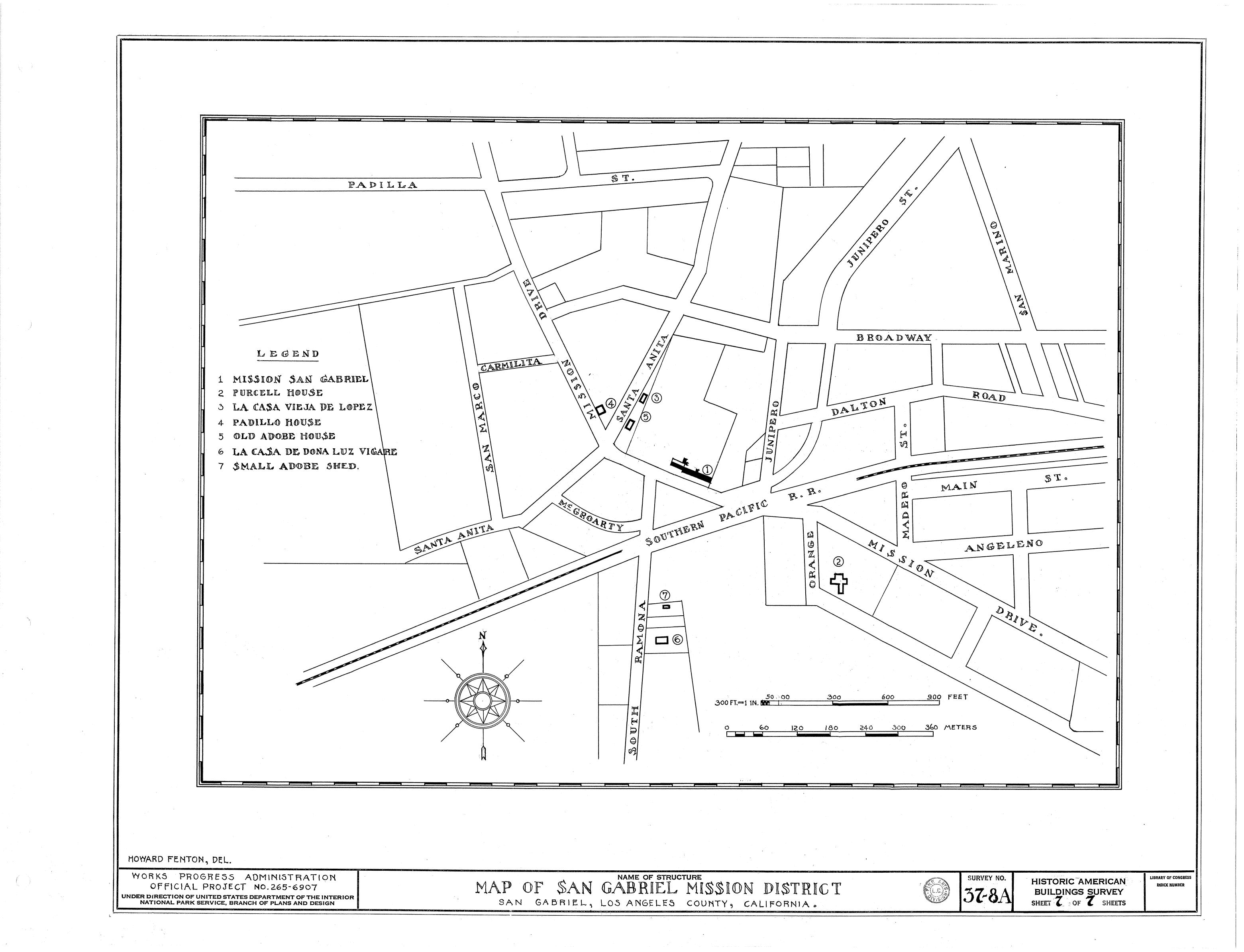
A map of the San Gabriel Mission District, Los Angeles County, California |
|---|---|
| Author(s)
|
Historic American Buildings Survey |
| Source
|
Historic American Buildings Survey / Historic American Engineering Record |
| Date created
|
1937 |
| Country of first publication
|
United States |
| Notes
|
You can edit this page and add notes here which may be useful to people who wish to re-use this media. |
| Other versions
|
If there are other versions of this media on CZ, please list them here. |
| Using this image on CZ
|
Copy the code below to add this image to a Citizendium article, changing the size, alignment, and caption as necessary.
|
Please send email to manager A T citizendium.org .
Licensing
This media, Map of San Gabriel Mission District.jpg, is in the public domain
This is a work of the United States Government, and as such is not afforded copyright protection under US law.
For further information see Title 17, Chapter 1, Section 105 of the US Code.
You may freely copy, distribute, display and perform this work, as well as make derivative and commercial works.
File history
Click on a date/time to view the file as it appeared at that time.
| Date/Time | Thumbnail | Dimensions | User | Comment | |
|---|---|---|---|---|---|
| current | 19:56, 11 March 2022 | | 3,122 × 2,389 (663 KB) | Maintenance script (talk | contribs) | == Summary == Importing file |
You cannot overwrite this file.
File usage
The following page uses this file: