File:Pmmap.jpg: Difference between revisions
Jump to navigation
Jump to search
imported>Anthony Argyriou ({{Information |Description= Map of the United States showing the principal meridians and baselines used in the Public Land Survey System|Source= [http://www.blm.gov/cadastral/meridians/pmmap.jpg BLM map] from [http://www.blm.gov/cadastral/meridians/meridians.htm Cadastral Survey page]|Date= 1988|Author= U.S. Geological Survey|Permission= Work of U.S. Government.}}) |
(== Summary == Importing file) Tag: Server-side upload |
||
| (3 intermediate revisions by 2 users not shown) | |||
| Line 1: | Line 1: | ||
== Summary == | == Summary == | ||
Importing file | |||
Latest revision as of 19:52, 11 March 2022
Summary
Importing file
File history
Click on a date/time to view the file as it appeared at that time.
| Date/Time | Thumbnail | Dimensions | User | Comment | |
|---|---|---|---|---|---|
| current | 19:52, 11 March 2022 | 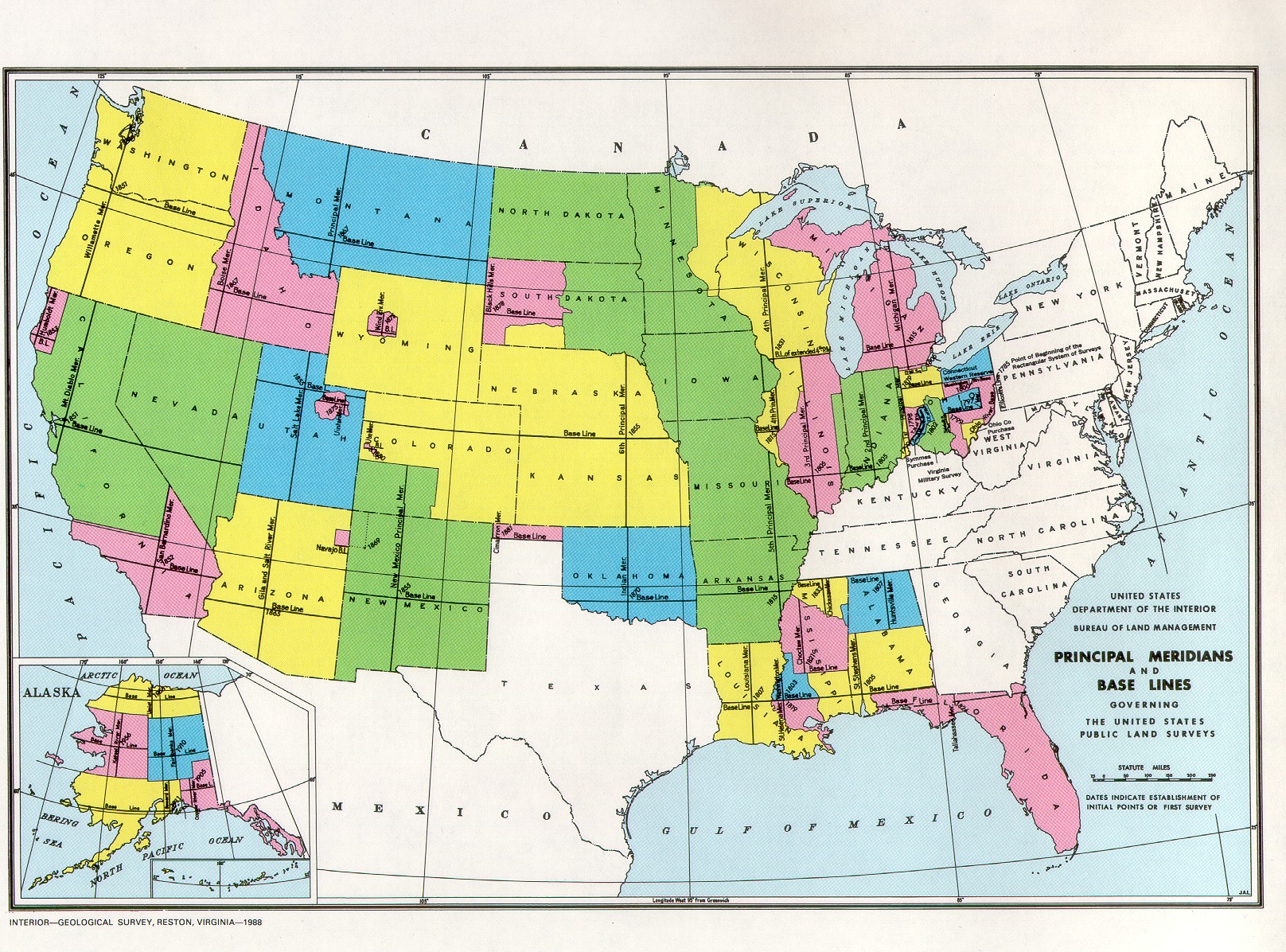 | 1,616 × 1,196 (760 KB) | Maintenance script (talk | contribs) | == Summary == Importing file |
You cannot overwrite this file.
File usage
The following 3 pages use this file: