Falls of the Ohio

From Citizendium
Jump to navigation Jump to search
This article is a stub and thus not approved.
Main Article
Discussion
Definition [?]
Related Articles  [?]
Bibliography  [?]
External Links  [?]
Citable Version  [?]
 
This editable Main Article is under development and subject to a disclaimer.
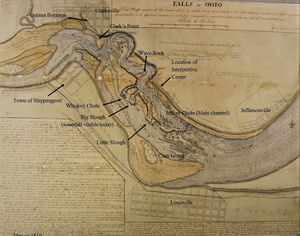
1810 map of the Falls of the Ohio
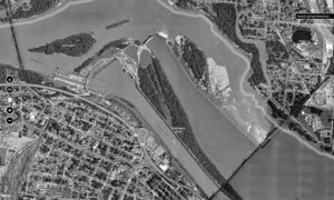
modern aerial photo of the area of the Falls. Note the southernmost channel is a modern canal.

A ridge of rock crosses the Ohio River, at Louisville, Kentucky, known as the Falls of the Ohio. It was the only navigational obstacle on the river. Passengers and cargo had to be portaged, until a canal was constructed.